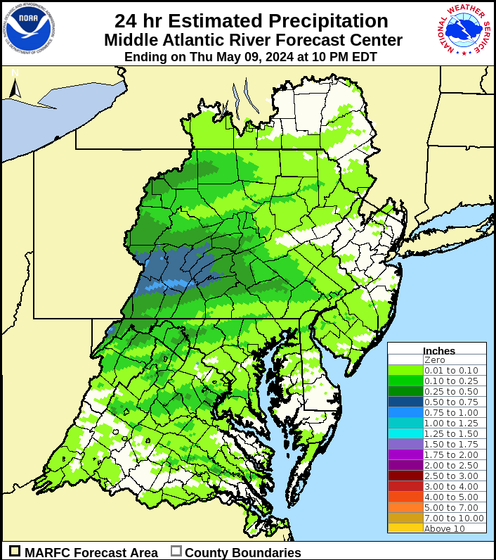
Middle Atlantic River Forecast Center's Observed Precipitation:
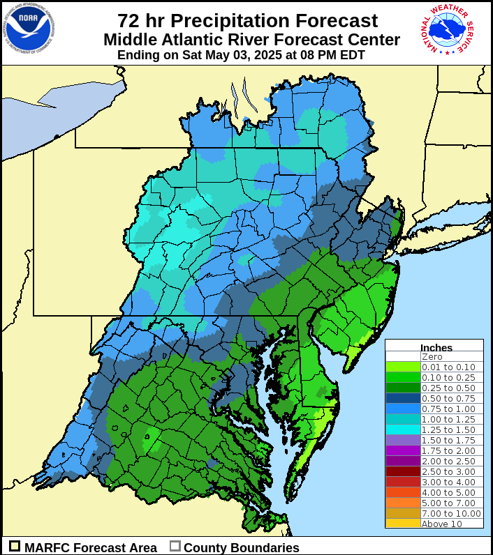
Middle Atlantic River Forecast Center's Forecasted Precipitation:
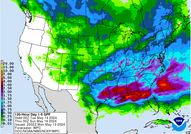
National Weather Service's 5-Day Total Precipitation:
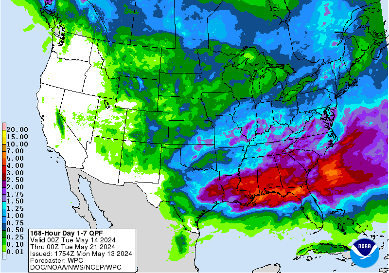
National Weather Service's 7-Day Total Precipitation:
U.S. Geological Survey's Daily Flows:
U.S. Geological Survey's Water Watch:
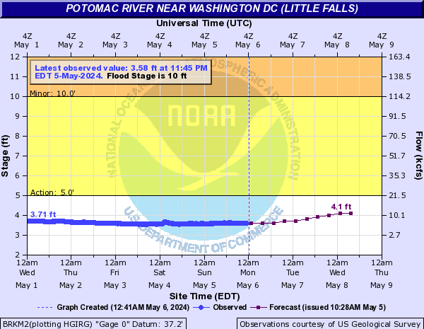
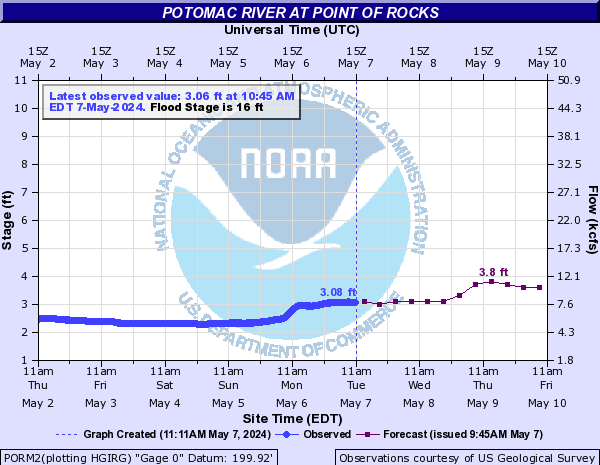
Middle Atlantic River Forecast Center's River Forecasts:
Additional Data and Forecasts:
- Middle Atlantic River Forecast Center's Precipitation Departure Maps
- U.S. Drought Monitor
- National Weather Service Climate Prediction Center
- U.S. Geological Survey
- Middle Atlantic River Forecast Center Self Briefing Page
- National Weather Service Weather Prediction Center
- National Weather Service River Forecasts
- National Weather Service Meteorological Model Ensemble River Forecasts
- U.S. Army Corps of Engineers Potomac River Basin
- Palmer Drought Index Map
- Palmer Drought Index Text